It is time for Christmas plans to be formalised. I’ve been thinking and tweaking my plans over the past week and have come up with an awesome but some what vague route. Starting from the highest point in Australia I will tootle into Jindabyne, meander south through the Snowy Mountains, wander through the Victorian Alps and then roll down hill to the coast.
I have made an incredibly detailed and comprehensive plan which involves a google map and a distance. Most importantly of all I know that the one store along the route will be open when I pass through.
So in summary I will be starting at the highest point in Australia, will ride through lots and lots of hills and then down to the coast. I will start taking bets on how many vertical meters I will ride in the 2228m between top and bottom.
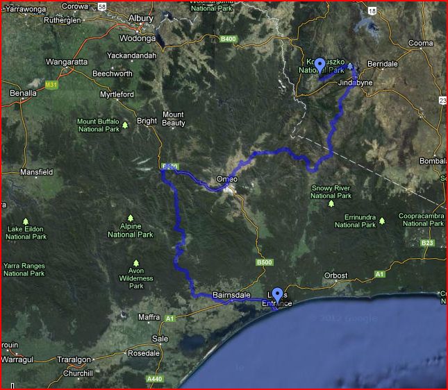
Route for my summer ride. There should be plenty of hills along the route.
Categories: Australia, New South Wales, Victoria
Tags: Australia, Border Ride, Cycle Touring, Cycling

Talk to me. Some research on my part early this morning indicates mr google is putting you on (poorly defined) walking. tracks, and that due to recent floods and storms many tracks are closed. Further detailed inquiries could be very worthwhile. Smooch.
I agree with the track condition comments – the Vic highlands are never the same twice!
I don’t think that the Barry Way counts as a track so much does it?
Your Christmas trip sounds great! How long do you plan to spend? Will you be camping?
I will be out for about a week which should be great, and yes I will be camping. The whole point of riding along dirt roads in the middle of no where is to avoid sleeping indoors right?
I guess it could also be about riding in some amazing places, maybe…
Good luck! Look like it will be an awesome trip!
I’m jealous, you’ll be drinking this yummy water from the snowy river: http://thodo.nl/photos/2012/jan/10/23:41:26